


The Ultimate Civil Suite
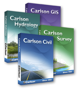
Carlson Software’s Civil Suite is a powerful bundle made up of: Carlson Survey, Carlson Civil, Carlson Hydrology, and Carlson GIS. These four civil-related modular programs, working together, provide the ultimate civil package that will help you dramatically increase your productivity and create better designs.
Here is a complete toolset that allows you to move into 3D as needed. Get 3D intersection design, multi-baseline road networks, lot layout, storm and utility analysis and design, plus much, much more. If you can imagine it, the Carlson Civil Suite has the industry-leading software tools to make it a reality.
Other top features that are in all Carlson 2018 releases include the ability to Fix Text Overlaps either automatically or manually; to Geolocate DWG Files with the new command to display placemarks in Google Earth; and the ability to set sun position by location and time in the 3D Viewer Window.
Support for AutoCAD® 2018 and the improved and stabilized IntelliCAD®8.3 join enhanced features in the just released Carlson Civil 2018, Carlson Hydrology 2018, and Carlson GIS 2018 modules. In addition to working with AutoCAD 2018, AutoCAD versions 2010 and up are also supported.
Carlson Civil provides the most robust automation and ease-of-use of any civil design solution available today, and it does dynamic updating without a single custom object. Carlson software is provided as a perpetual license with no requirement to update every year—when you purchase Carlson Civil, Hydrology, or GIS, it is yours. If choosing to update each year, there is a convenient maintenance portal for customers — http://update2.carlsonsw.com/renew/. In addition, Carlson Software provides free technical support, which it has done since its founding in 1983.
* Call us @ 866-USSURVEY for best pricing!
CE News reported a business case study showing the extensive review that the civil engineering firm Dewberry went through to ultimately choose the Carlson Civil Suite for its 40 offices nationwide. “Carlson works for us,” says Dave Palumbo, PE, Technology Manager for Infrastructure Services for Dewberry. “It is highly cost effective and people are doing better work… I think they are also having fun!”
The Carlson line of software comes with 64-bit capabilities, is Windows 10 compatible, and works on AutoCAD® and IntelliCAD®.
Choose the suite if you need all of the powerful solutions and save. Or, choose them individually, based on the demands of your business. However you use Carlson Software Civil solutions, you’ll find both your creativity and productivity dramatically increased.
Features:
Drawing Cleanup
- Perform data integrity checks, convert proprietary objects into usable entities and eliminate wasteful redundancies with this powerful tool for control over the drawing no matter who had it before you.
Join Nearest
- Highly improved command that allows you to define tolerances and safety checks when joining objects together.
Shrink-Wrap Entities
- Time- and effort-saving method of defining boundaries.
Drawing Inspector
- Get an instantaneous and dynamic readout of bearings, distances, elevations and other information for Quality Assurance activities.
3D Viewer Window
- View perspectives and get elevational analysis of 3D data and surfaces with this tool, which has eleiminated the need for costly graphics hardware upgrades.
2D/3D Polyline Utilities
- With these, Carlson gives you tools to enhance the use of polylines that AutoCAD® doesn’t have.
Erase by Layer
- Save time eradicating data on layer(s) without having to isolate, erase and restore them.
Quick Keys Editor
- Quickly key in shortcut commands to speed your own projects.
Point Data Management
- Organize your point data with these valuable tools for setting, managing, modifying and reporting point data.
Product Data Management
- Define and Assign… Carlson Civil allows you, the end user, to definte your project folder structure in the way that makes sense to you and your organization, with as little or as much complexity as suits your needs, and then assign the data types used in the Carlson Civil Suite to the folers you’ve defined. At Carlson Software, we know that this is a critical key to your successful implementation of the software, so we let you design it yourself.
Surface Modeling
- Develop and analyze surfaces and their respective contours and lables in just one step. This tool eliminates the need to run a complex series of commands to perform this oft-needed function. External and sharable files are stored, various analyses are performed to ensure data integrity and automatic labeling guarantees that all contours are appropriately labeled with reactive annotation precisely as the user wishes.
Annotation
- Produce clean, well-documented project plans fast and efficiently with precise tools that use Carlson Civil’s library of annotation features. Carlson Civil allows you to introduce your own annotation style to personalize your drawing and provides the tools to quickly clean up complicated annotation challenges in dense drawings. Text overlaps are automatically checked and you have the option of allowing the software to correct it or choose the correction you prefer.
Volumes
- The Civil Suite’s volume computations use the industry’s most accurate algorithms and can be based directly on the source data, thereby eliminating any inaccuracies found in other algorithms. Detailed reports in a variety of ways, plus cut/fill labels, color maps and centroids in the drawing file can be produced, all with easy-to-use tools.
Testimonials:


