

Intuitive Field-to-Plan Software for Surveying
Survey Grade Accuracy Using Regular Cameras & UAVs
![]()
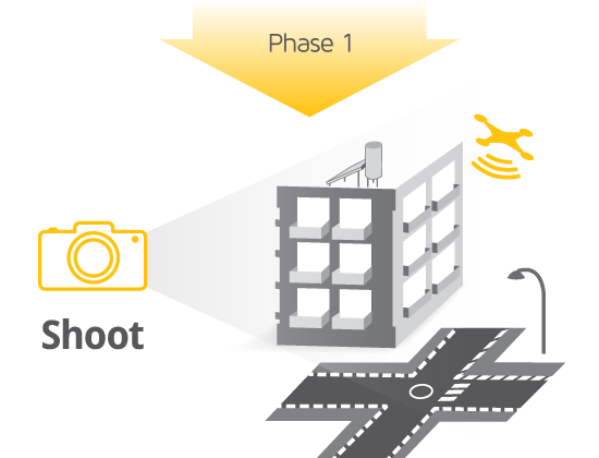
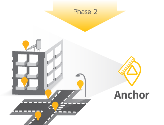
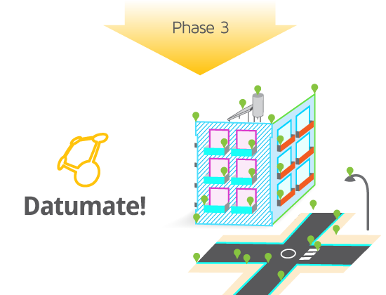
We are pleased to offer photogrammetry software from Tel Aviv-based Datumate. With DatuGram 3D, geodetic measurements and technical drawings can be created directly from images of regular cameras, at sub-cm accuracy. Using DatuGram 3D, both field and office work of topographic and as-built surveys is made easier, faster, safer and more accurate.
With DatuGram 3D you don't need a scanner, just a camera and control points, to meet your clients' needs!
Call us for pricing or to inquire about training opportunities